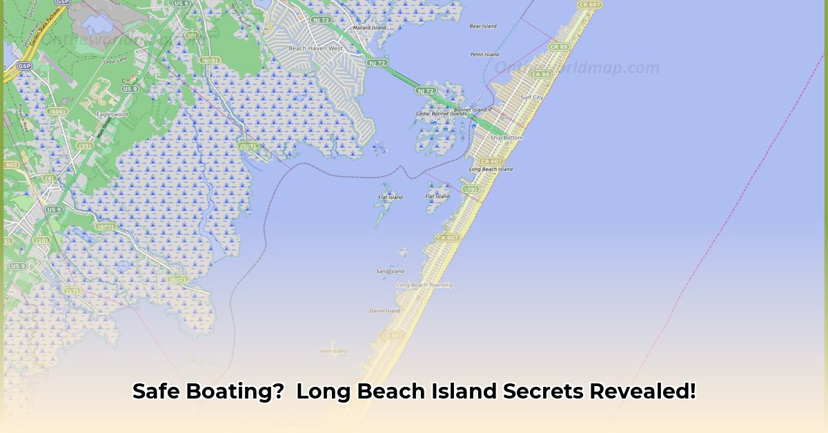
Long Beach Island (LBI) offers exceptional boating opportunities, but safe navigation requires a synergistic approach combining modern technology with classic nautical skills. Relying solely on one method is risky; this guide emphasizes the importance of using both digital and traditional navigation tools for a smooth and safe boating experience. For a visual aid, check out this LBI map.
Charting Your Course: High-Tech and Old-School Teamwork
Before launching, prepare your navigation system. You'll need a detailed nautical chart app and a paper chart—your all-star navigation team.
Your chart app provides real-time location, depth, and even nearby boat traffic. But, what if your phone's battery dies or the app malfunctions? Your paper chart serves as a crucial backup, offering a broader overview, even without cell service. Mastering both is essential for confident navigation.
Weather: Your Trip's Wildcard
LBI's weather is unpredictable, shifting rapidly. Always check forecasts before departure and regularly throughout your trip. Use multiple sources (National Weather Service, marine weather apps, radio reports) to cross-reference data and avoid dangerous surprises. A sudden squall can quickly transform a pleasant voyage into a serious situation. Are you prepared for unexpected weather changes?
Real-World Lessons: Learning from Others' Experiences
Consider this: Your app loses signal, leaving you reliant on your paper chart. This isn't hypothetical; it happens frequently! This underscores the necessity of proficiency in both digital and traditional navigation. Your paper chart is your Plan B. Further, paper charts may show details—shallow areas or obstacles—not yet updated on your app—avoiding potential grounding.
Navigational Tools: The Power of Synergy
This step-by-step guide outlines a smart navigation strategy:
Pre-Trip Planning: Carefully plan your route using your app and paper chart. Identify landmarks, hazards (shallow areas, rocks), and safe anchorages.
On-the-Water Navigation: Use your app for real-time updates, but constantly compare this information with your paper chart (as an independent verification).
The Backup Plan: If your app fails, your paper chart is your lifeline. Familiarize yourself with compass and traditional chart reading.
Weather Watch: Continuously monitor weather forecasts from multiple sources and adjust your plans accordingly.
Safety First: Always prioritize safety. Follow navigation rules and regulations, and maintain awareness of your surroundings and other vessels.
Long Beach Island Navigation: Understanding the Risks
This risk assessment matrix outlines common boating hazards and mitigation strategies on LBI.
| Risk Factor | Likelihood | Impact | Mitigation |
|---|---|---|---|
| App Malfunction | Medium | High | Carry backup paper charts; master basic paper chart navigation techniques. |
| Inaccurate Weather Data | Low | Medium | Cross-reference weather data; remember that forecasts aren't perfectly accurate. |
| Human Error | High | High | Practice chart reading; seek professional training; double-check all information. |
| Collisions | Medium | Very High | Maintain a sharp lookout; strictly adhere to navigation rules and regulations. |
How to Use Nautical Chart Apps and Paper Charts Together for Safe Boating in Long Beach Island
Combining digital and traditional methods is key to safe LBI navigation. Let's explore how to integrate them seamlessly.
Understanding Your Tools: Digital vs. Paper
Digital apps offer real-time updates, weather overlays, and route planning. They act as your intelligent co-pilot. However, paper charts provide a reliable backup, unaffected by technology. The combination creates a robust navigation system.
How to Use Nautical Chart Apps and Paper Charts Together
Pre-Trip Planning: Plan your route using a nautical chart app. Note hazards and print a relevant section from your paper chart.
Cross-Referencing: Use your app for real-time positioning and environmental monitoring, but constantly compare this data with your paper chart.
Handling Discrepancies: Investigate any differences between your app and paper chart (e.g., a newly placed buoy). Prioritize safety; contact authorities if necessary.
Emergency Situations: In case of app failure, your paper chart is your primary navigation tool. Proficiency in its use is critical.
Post-Trip Review: Review your route on both your app and paper chart to reinforce skills and identify areas for improvement.
Navigating Long Beach Island's Specific Challenges
LBI presents unique challenges: strong currents, shifting sandbars, and shallow inlets. Understanding these characteristics and verifying information from both charting methods is paramount.
Pros and Cons of Each Method
| Feature | Paper Charts | Digital Apps |
|---|---|---|
| Reliability | High (unaffected by technology) | Moderate (dependent on device, signal, app functionality) |
| Detail | Detailed, but static | Detailed, real-time updates |
| Portability | Can be bulky, requires storage | Highly portable, easily updated |
| Cost | Relatively low initial cost, needs infrequent updates | Higher initial cost (app purchase, device), ongoing updates |
| Environmental Factors | Unaffected by weather or signal interference | Subject to weather and signal interference |
Key Takeaways:
- Redundancy is Crucial: Avoid relying on a single navigation system. Combining paper and digital ensures safety.
- Regular Chart Updates: Keep both your paper charts and app data current.
- Understand Limitations: Be aware of each system's limitations and plan accordingly.
- Prioritize Safety: When in doubt, exercise caution and investigate discrepancies.
- Practice: Regular practice with both methods enhances your skills and builds confidence.